Civil 3D design services
What Is Civil 3D Design & Land Development?
Civil 3D Design is a specialized engineering discipline that uses Autodesk's AutoCAD Civil 3D software to create intelligent, data-rich models for land development, infrastructure, and site design projects. Unlike traditional CAD drafting, Civil 3D creates dynamic models where changes to one element automatically update all related drawings saving enormous amounts of time and reducing errors dramatically. Land Development encompasses the complete process of transforming raw or undeveloped land into a usable, infrastructure-ready site including roads, drainage systems, utilities, grading, and all associated civil engineering works.
Why Professional Civil 3D Design Matters
Poor civil engineering design leads to costly construction errors, drainage failures, regulatory rejections, and project delays. Professional Civil 3D design ensures:
- ✅ Accurate grading & drainage that prevents flooding and erosion
- ✅ Regulatory compliance with local, state & federal requirements
- ✅ Optimized earthwork calculations that reduce construction costs
- ✅ Efficient utility routing for water, sewer & storm systems
- ✅ Faster permit approvals with professionally prepared documents
- ✅ Reduced construction errors through precise design documentation
- ✅ Better project coordination between all engineering disciplines
- ✅ Cost-effective land use through intelligent site planning
Our Complete Civil 3D & Land Development Services
Our core service — we use Autodesk AutoCAD Civil 3D to create intelligent, dynamic civil engineering models and drawings for all types of land development and infrastructure projects with maximum accuracy and efficiency.
Includes:
- Civil 3D Surface Modeling
- Civil 3D Corridor Design
- Civil 3D Pipe Network Design
- Civil 3D Grading & Earthwork
- Civil 3D Parcel Design
- Civil 3D Profile & Alignment
- Civil 3D Point & Survey Data Management
- Civil 3D Plan & Profile Sheets
- Civil 3D Label & Annotation
- Civil 3D Report Generation
Land Development Site Design
Our land development experts provide complete site design services from initial feasibility analysis and conceptual planning through to final construction document preparation for residential, commercial, industrial, and mixed-use developments.
Includes:
- Site Feasibility Analysis
- Conceptual Site Layout Design
- Preliminary Site Plan Design
- Final Site Plan Development
- Zoning & Setback Compliance Review
- Lot Layout & Subdivision Design
- Access & Circulation Planning
Grading & Drainage Design
Proper grading and drainage design is absolutely critical for any land development project. Our civil engineers create precise grading plans that manage stormwater effectively, prevent erosion, and ensure long-term site stability.
Includes:
- Site Grading Plan Development
- Cut & Fill Earthwork Analysis
- Stormwater Management Design
- Drainage Basin Analysis
- Swale & Channel Design
- Detention & Retention Pond Design
- Erosion & Sediment Control Plans
Right Of Way & Acquisition Graphics
Our right of way graphics team prepares precise legal exhibits, acquisition plats, and presentation graphics for highway, utility, and infrastructure right of way acquisition projects.
Includes:
- Right of Way Acquisition Plats
- Temporary Construction Easements
- Permanent Easement Exhibits
- Legal Description Support Graphics
- Highway ROW Drawings
- Utility Easement Graphics
Civil Site Design Plans — Complete Package
We prepare complete civil site design plan sets for permit submission including all required sheets from cover sheet through construction details formatted for your local jurisdiction’s requirements.
Includes:
- Cover Sheet & General Notes
- Existing Conditions Plan
- Demolition Plan
- Site Layout Plan
- Grading & Drainage Plan
- Utility Plan
- Erosion Control Plan
Our Proven 7-Step Civil 3D Design Process
Step 1 — 📋 Project Information & Data Collection Share your project information including survey data, topographic data, existing utility information, zoning requirements, and any other relevant project documentation. We review all available data before beginning design.
Step 2 — 💬 Free Consultation & Scope Definition Our civil engineering team reviews your project requirements and provides a detailed free quote covering the complete scope of work, deliverables, applicable design standards, and project timeline.
Step 3 — 🗺️ Existing Conditions & Base Map Preparation We prepare a comprehensive existing conditions plan incorporating survey data, aerial imagery, utility records, and all available site information — creating the accurate base from which all design work proceeds.
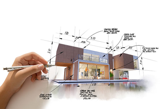
Step 4 — 📐 Conceptual Design & Layout Our engineers develop the conceptual site layout — including road alignments, lot layouts, utility routing, and grading concepts — and present it for your review and approval before proceeding to detailed design.
Step 5 — ⚙️ Detailed Civil 3D Design Using AutoCAD Civil 3D, our team develops the complete detailed design including grading, drainage, utilities, roadways, and all associated civil engineering elements to the level required for permit submission.
Step 6 — 🔍 Quality Control & Engineering Review Every drawing set goes through a rigorous multi-level quality control review — checking design accuracy, code compliance, dimensional correctness, and drawing standards before delivery.
Step 7 — 📦 Plan Set Delivery & Permit Support We deliver your complete civil engineering plan set in your preferred format. We also provide ongoing support during the permit review process — responding to agency comments and preparing required revisions promptly.
Civil Engineering Software We Use
Our civil engineering team is proficient in the most advanced and widely used civil design software:
- 🌍 AutoCAD Civil 3D — Primary Civil Design Platform
- 📐 AutoCAD Land Desktop (LDD) — Legacy Land Development Design
- 💧 HEC-RAS — Hydraulic & Flood Analysis
- 🌊 StormCAD — Storm Sewer Hydraulic Modeling
- 🚰 WaterCAD — Water Distribution System Modeling
- 🔧 SewerCAD — Sanitary Sewer System Modeling
- 🗺️ ArcGIS — Geographic Information System
- 📊 Hydraflow — Stormwater Hydrology Analysis
- 🏗️ Autodesk Revit — BIM Civil Coordination
- 📋 MicroStation — Alternative CAD Platform