AutoCAD Civil 3D Design
Precise. Intelligent. Delivered On Time. Every Time.
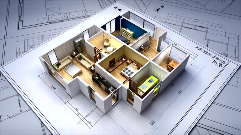
At Engineer7, we deliver comprehensive AutoCAD Civil 3D Design Services that help civil engineers, land developers, surveyors, and construction firms design, draft, and document civil engineering projects with exceptional speed, accuracy, and efficiency. Powered by Autodesk's industry-leading AutoCAD Civil 3D software, our expert civil design team transforms raw survey data, site concepts, and engineering requirements into precise, permit-ready civil engineering drawings and intelligent 3D design models. From simple site grading plans to complex multi-discipline infrastructure projects 3Engineer is your trusted AutoCAD Civil 3D design partner.
What Is AutoCAD Civil 3D?
AutoCAD Civil 3D is Autodesk’s industry-leading software platform for civil engineering design and documentation. Unlike standard AutoCAD which produces static 2D drawings Civil 3D creates intelligent, dynamic design models where every element is interconnected. Change a road alignment and the profile updates automatically. Adjust a grading design and the earthwork volumes recalculate instantly. Modify a pipe network and all related plan and profile sheets update in real time.
This intelligent, dynamic design environment makes AutoCAD Civil 3D the most powerful and efficient tool available for:
- 🏘️ Land Development & Subdivision Design
- 🛣️ Road & Highway Design
- 🌊 Grading & Drainage Design
- 🚰 Utility & Infrastructure Design
- 📐 Survey & Mapping
- 🌿 Site Design & Planning


Our Complete AutoCAD Civil 3D Design Services
Civil 3D Site Design & Planning
Our civil site design service covers the complete design and documentation of development sites — from initial feasibility and conceptual layout through to final permit-ready construction drawings. We use AutoCAD Civil 3D to create intelligent site models that allow rapid design iteration and accurate quantity generation.
Includes:
- Existing Conditions Base Map Preparation
- Conceptual Site Layout Design
- Preliminary & Final Site Plan Development
- Zoning & Setback Compliance Review
- Lot Layout & Parcel Design
- Access Road & Circulation Design
- Parking Layout & Design
- Site Amenity & Feature Design
- Construction Document Preparation
- Permit Drawing Set Production
Grading & Earthwork Design
Accurate grading design is the foundation of every successful land development project. Our Civil 3D grading specialists design precise grading plans that manage stormwater effectively, create usable building pads, and minimize earthwork costs all backed by accurate cut and fill volume calculations directly from the Civil 3D surface model.
Includes:
- Civil 3D Existing Ground Surface Modeling
- Proposed Grading Surface Design
- Building Pad & Finished Floor Elevation Design
- Parking & Driveway Grade Design
- Swale & Channel Grading
- Cut & Fill Volume Calculations
- Mass Haul Analysis
- Grading Plan Production
- Spot Elevation & Contour Plan
- Grading Detail Drawings

Stormwater & Drainage Design
Our drainage design team uses AutoCAD Civil 3D’s powerful pipe network tools combined with hydraulic modeling software to design efficient stormwater collection and conveyance systems that meet all regulatory requirements and protect developments from flooding.
Includes:
- Stormwater Drainage System Design
- Storm Sewer Pipe Network Design
- Catch Basin & Inlet Design & Placement
- Storm Pipe Sizing & Hydraulic Analysis
- Detention & Retention Basin Design
- Underground Storm Chamber Design
- Bioretention & Rain Garden Design
- Stormwater Management Report
- Storm Sewer Plan & Profile Drawings
- Hydraulic Grade Line Analysis
Road & Driveway Design
Our road design team delivers complete roadway design services for private roads, subdivision streets, commercial driveways, and access roads from horizontal and vertical alignment selection through to complete construction document production using AutoCAD Civil 3D corridors.
Includes:
- Horizontal Alignment Design
- Vertical Profile Design
- Civil 3D Corridor Modeling
- Road Cross-Section Design & Superelevation
- Intersection Design & Layout
- Cul-de-Sac & Turnaround Design
- Curb, Gutter & Sidewalk Design
- ADA Ramp & Accessibility Design
- Road Plan & Profile Sheet Production
- Road Construction Detail Drawings


Our Simple 6-Step AutoCAD Civil 3D Design Process
Step 1 — 📋 Share Your Project Information Send us your survey data, topographic information, site plans, zoning requirements, utility records, and any other available project documentation. We review everything thoroughly before beginning work.
Step 2 — 💬 Free Consultation & Quote Our civil engineering team reviews your requirements and provides a detailed free quote covering the complete scope, applicable design standards, deliverable formats, and project timeline — with no hidden costs or surprises.
Step 3 — 🗺️ Existing Conditions & Base Map We prepare a comprehensive existing conditions base map — incorporating all available survey data, aerial imagery, utility records, and site information — creating the accurate foundation from which all design work proceeds.
Step 4 — 📐 Civil 3D Design Development Using AutoCAD Civil 3D, our team develops the complete design — grading, drainage, roads, utilities, and all associated civil elements — building an intelligent, dynamic design model that allows rapid refinement and accurate quantity generation.
Step 5 — 🔍 Quality Control & Engineering Review Every design and drawing set goes through a rigorous multi-level quality control review — checking design accuracy, code compliance, dimensional correctness, and drawing completeness before delivery.
Step 6 — 📦 Drawing Delivery & Permit Support We deliver your complete civil drawing set in PDF and DWG formats. We also provide ongoing support during the permit review process — preparing responses to agency comments and revised drawings as required until your permit is approved.